
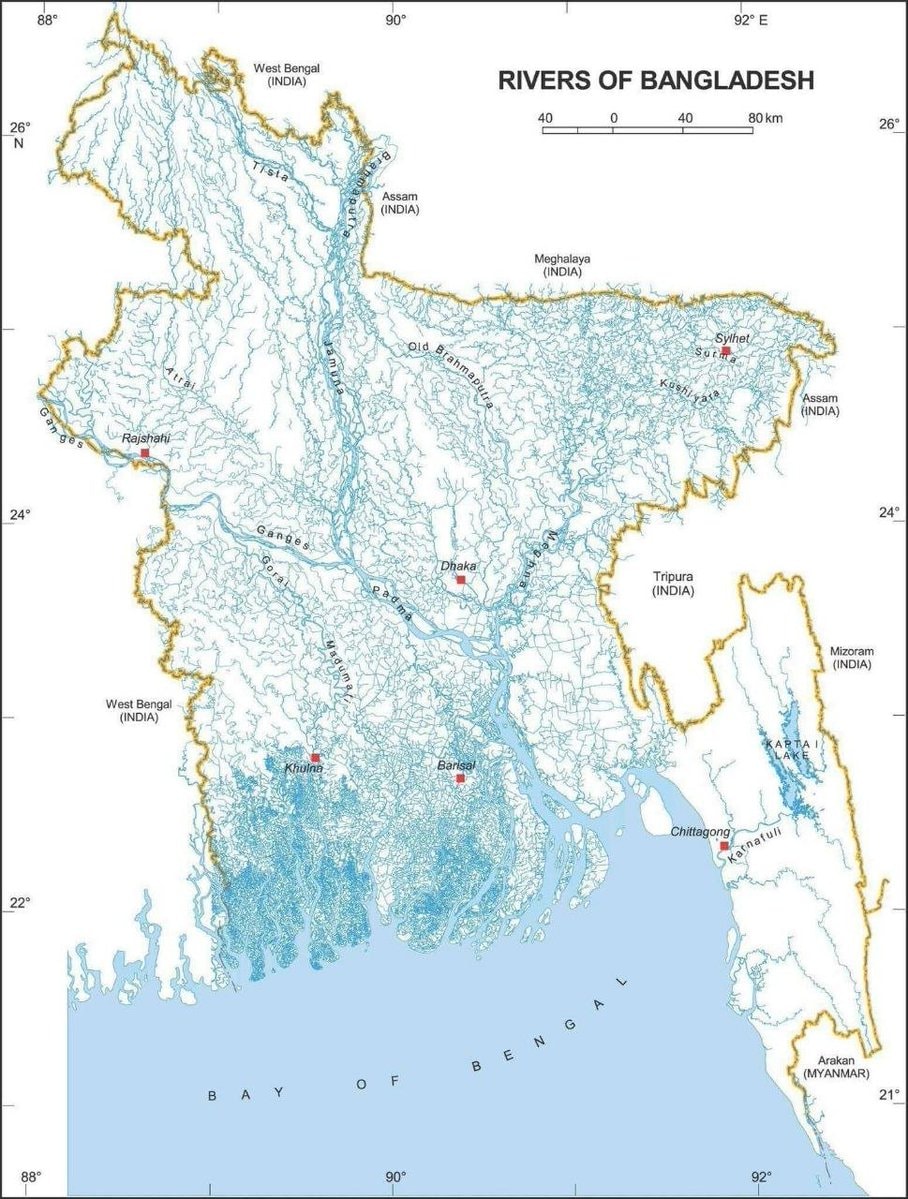
@savageupdatesA MAP OF BANGLADESH'S 700+ RIVERS not a digital circuit 😱 this is insane 🇧🇩⛱️
Vedi post originale@savageupdatesA MAP OF BANGLADESH'S 700+ RIVERS not a digital circuit 😱 this is insane 🇧🇩⛱️
Vedi post originaleFoto di @savageupdates· Jul 10, 2026· Bangladesh
The image is a map focused on the rivers of Bangladesh and surrounding regions. It displays a dense network of blue lines representing rivers and waterways across the landmass, with major cities marked by red squares. The overall style is that of an educational or informational map, with clear labels and a scale bar. Notable details include the intricate river systems, the Bay of Bengal to the south, and bordering countries like India and Myanmar. The title at the top reads "RIVERS OF BANGLADESH".
@savageupdatesA MAP OF BANGLADESH'S 700+ RIVERS not a digital circuit 😱 this is insane 🇧🇩⛱️
Vedi post originaleFoto di @savageupdates· Jul 10, 2026· Bangladesh
The image is a map focused on the rivers of Bangladesh and surrounding regions. It displays a dense network of blue lines representing rivers and waterways across the landmass, with major cities marked by red squares. The overall style is that of an educational or informational map, with clear labels and a scale bar. Notable details include the intricate river systems, the Bay of Bengal to the south, and bordering countries like India and Myanmar. The title at the top reads "RIVERS OF BANGLADESH".
Ancora nessun commento. Sii il primo!
Ancora nessun commento. Sii il primo!