
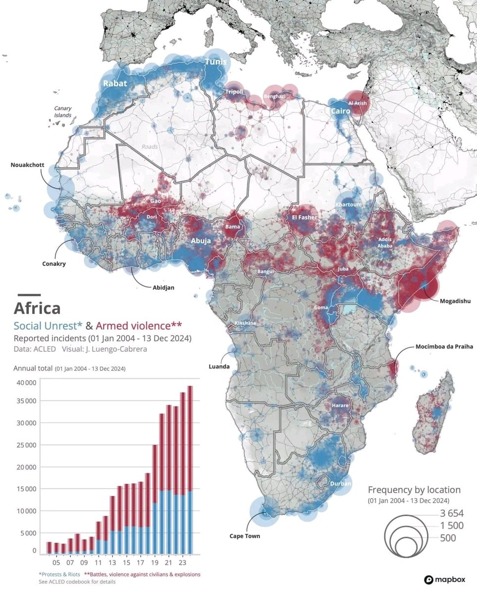
@savageupdatesJose Luengo-Carbrera maps out the hotspots across Africa.
Vedi post originale@savageupdatesJose Luengo-Carbrera maps out the hotspots across Africa.
Vedi post originaleFoto di @savageupdates· Aug 24, 2026· Info/Editorials
The image is a map of Africa showing areas of social unrest and armed violence. Red and blue circles indicate reported incidents, with larger circles representing higher frequency. A bar graph on the left shows the annual total of these incidents from 2004 to 2023. The overall mood is informative and serious, presented in a data-driven, analytical style. Visually notable are the dense clusters of red and blue circles in specific regions, highlighting areas of significant conflict. The map includes city names like Tunis, Rabat, Cairo, and Mogadishu, and a legend explaining the frequency by location. ON-SCREEN TEXT: Africa Social Unrest* & Armed violence** Reported incidents (01 Jan 2004 - 13 Dec 2024) Data: ACLED Visual: J. Luengo-Cabrera Annual total (01 Jan 2004 - 13 Dec 2024) Frequency by location (01 Jan 2004 - 13
 white ethnic groups by U.S. county
 India 1525 historical map
 Second most spoken language in Mexico
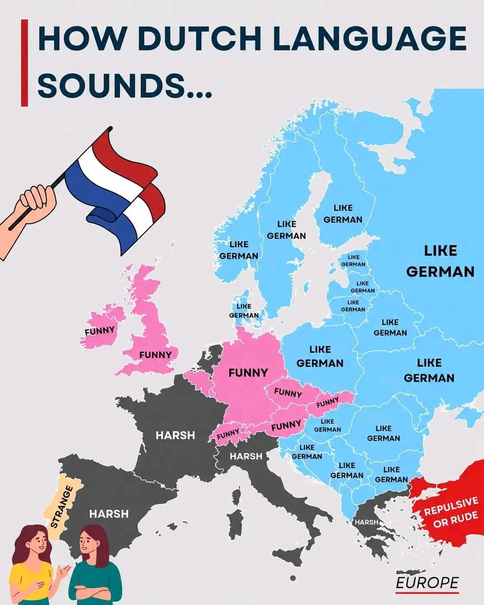 Dutch Language perception by region
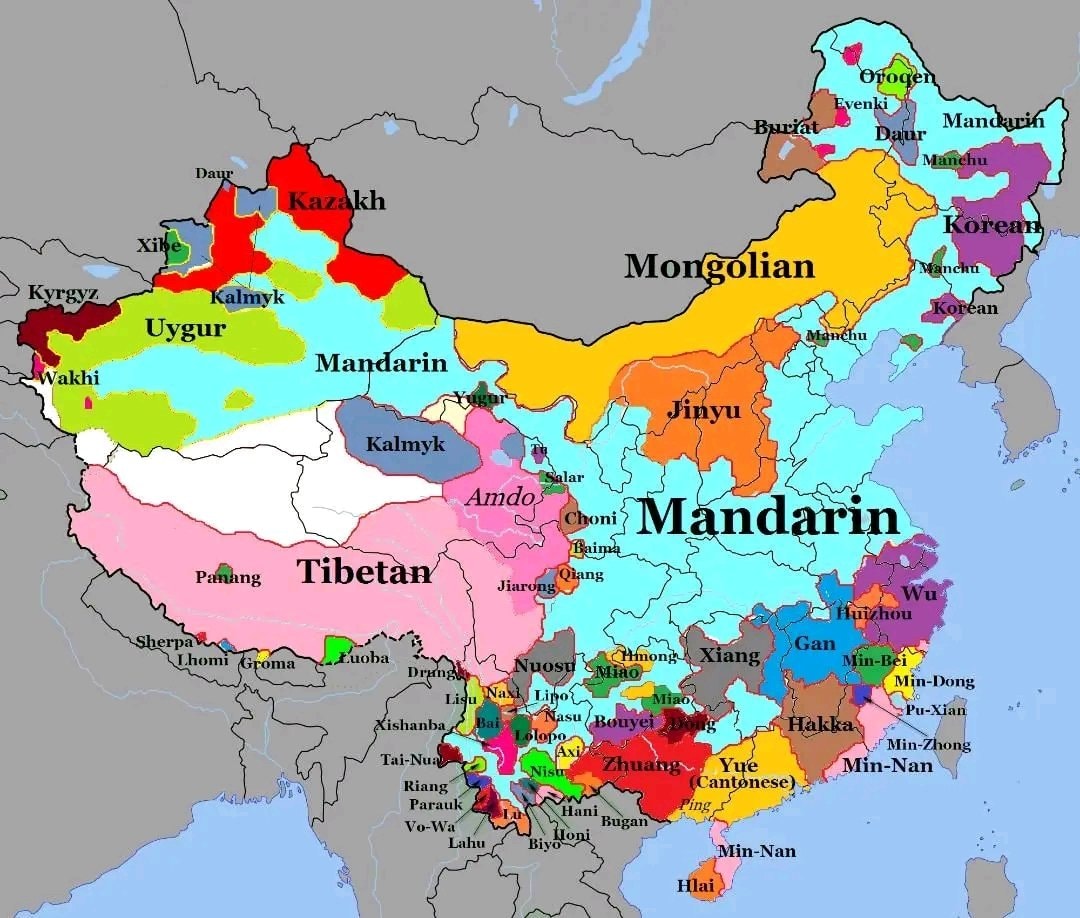 languages of China
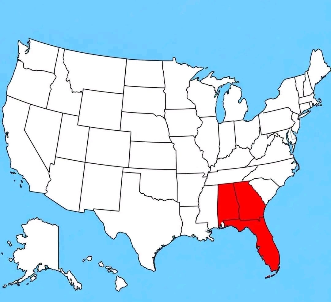 hypothetical US state map
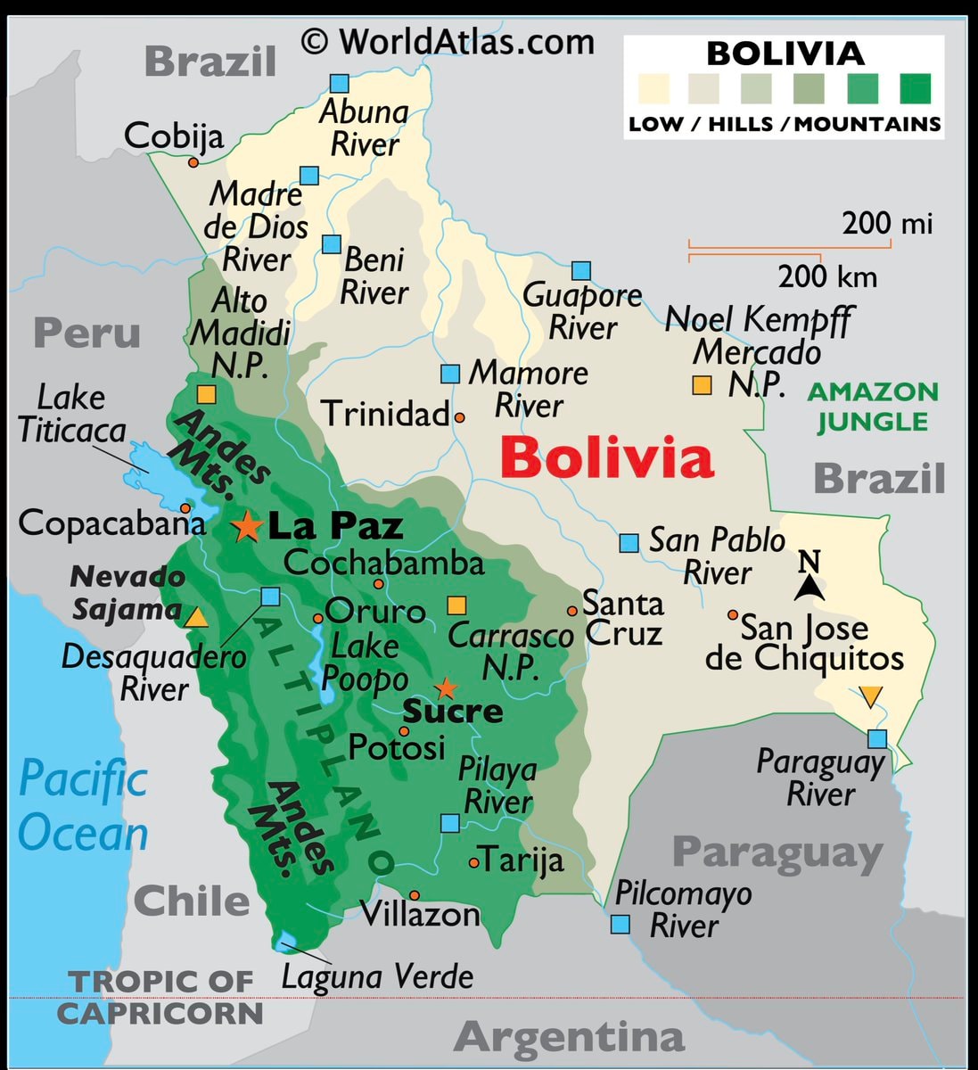 Bolivia map and facts
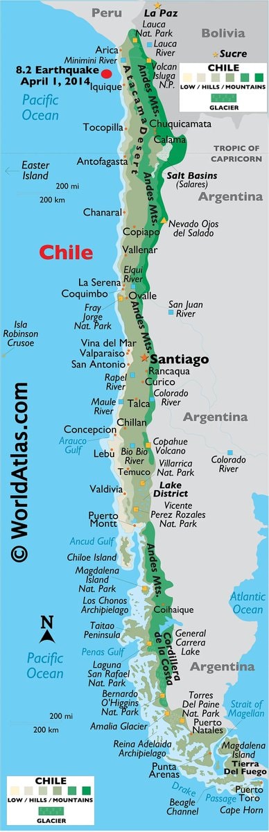 Chile map with facts
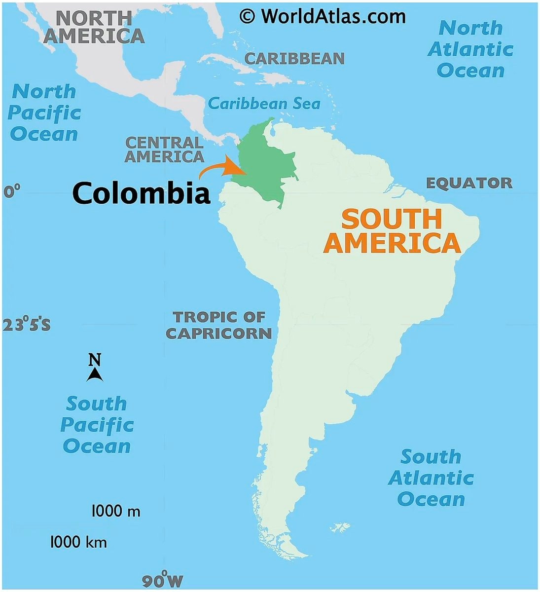 Colombia maps and facts
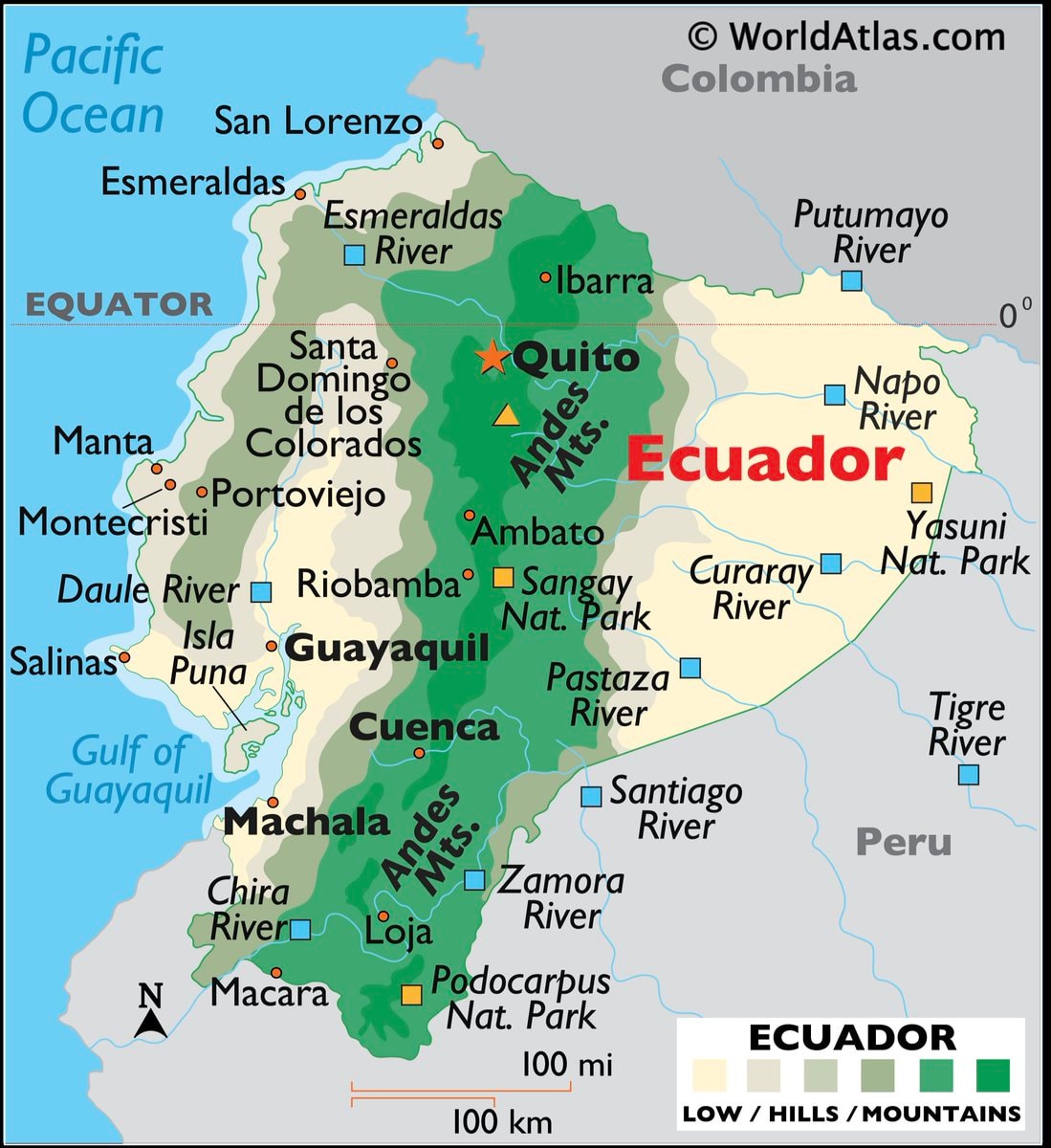 Ecuador map and facts
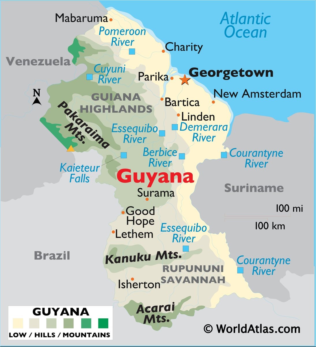 Guyana map and facts
 most common US road suffixes by county
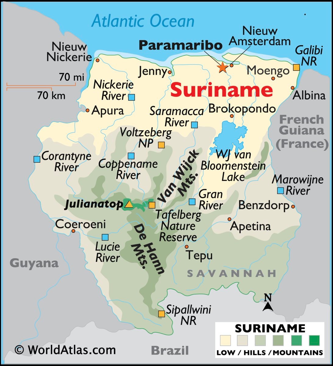 Suriname map and facts
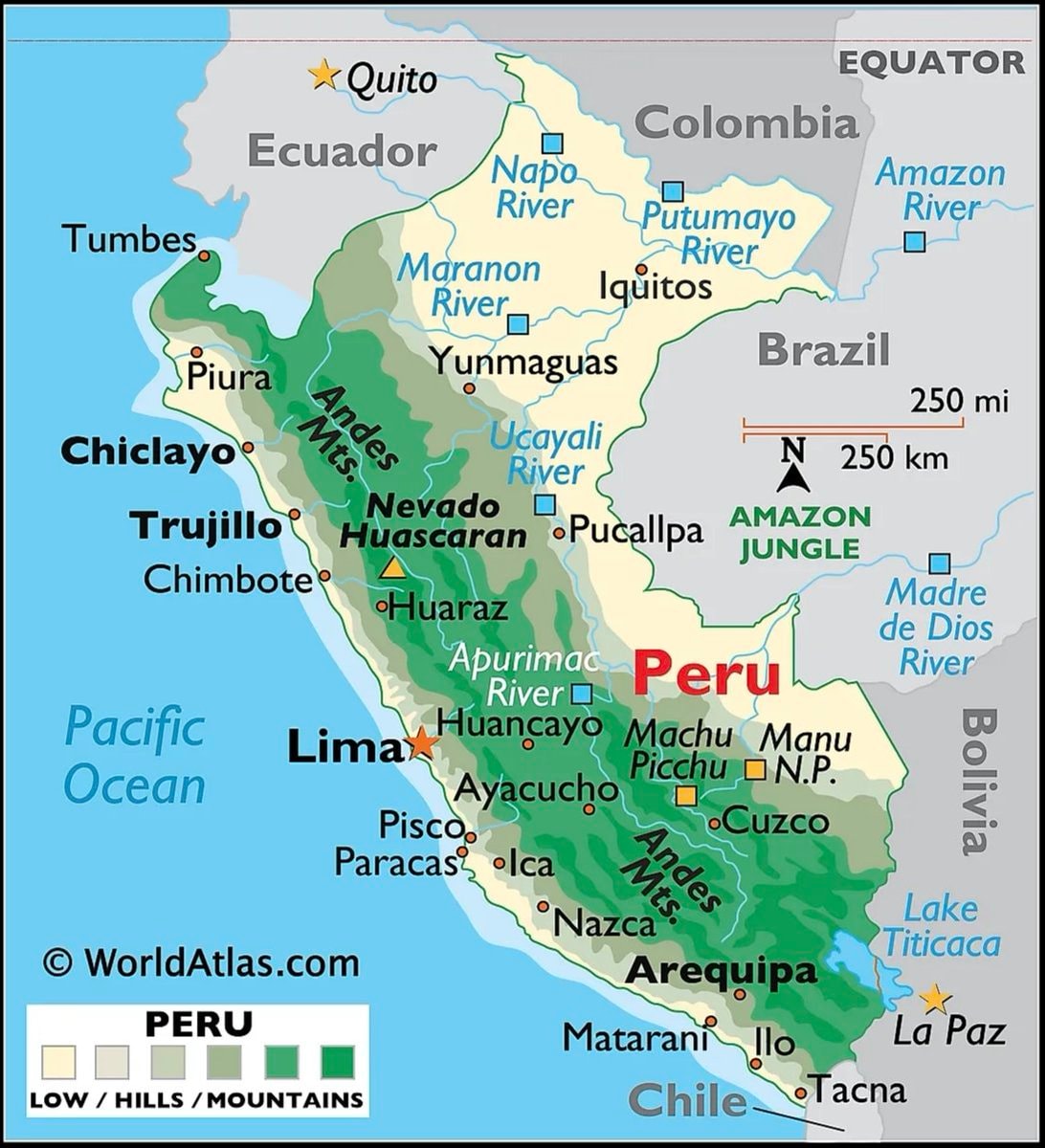 Peru map and country facts
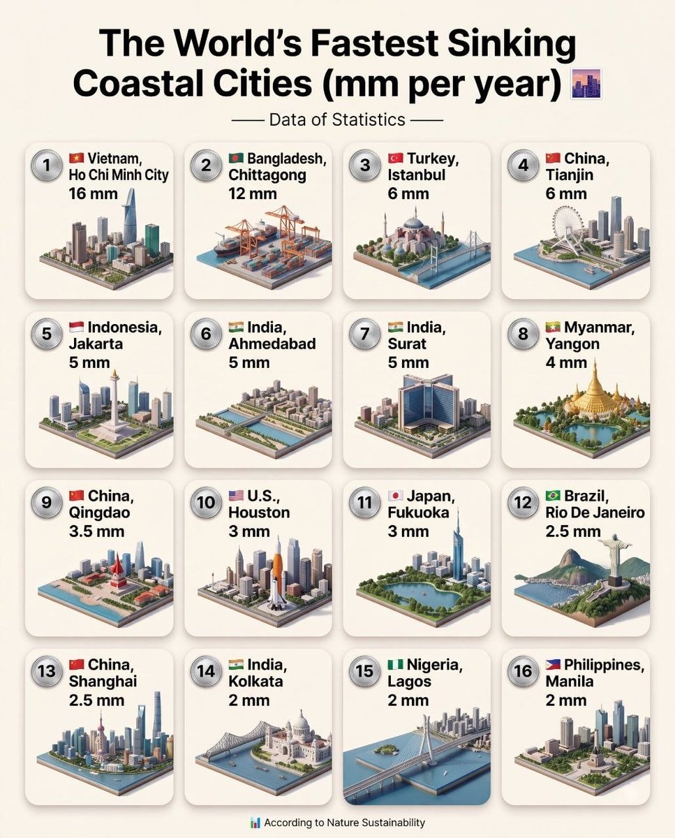 World's Fastest Sinking Coastal Cities
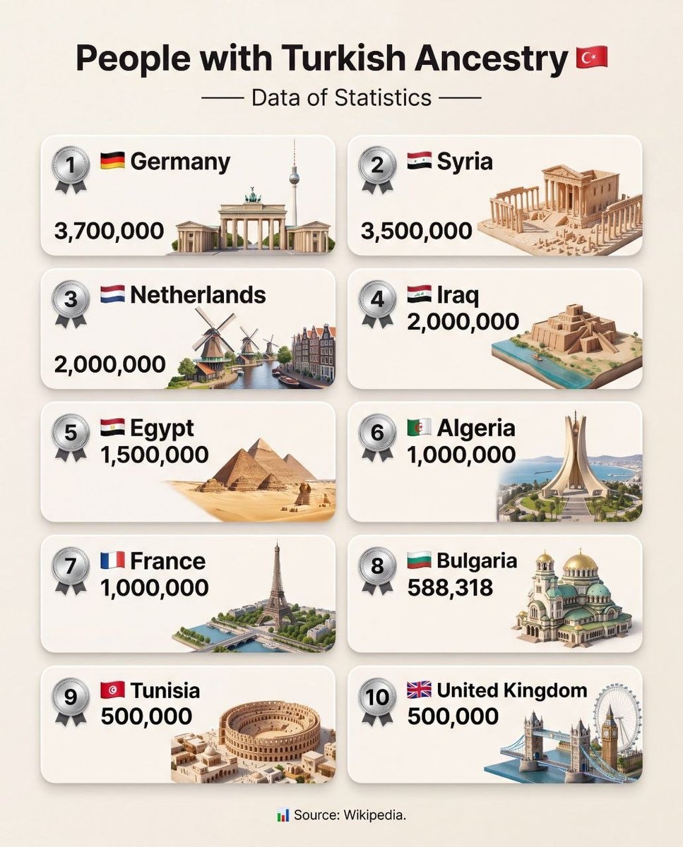 Turkish Ancestry Population Rankings
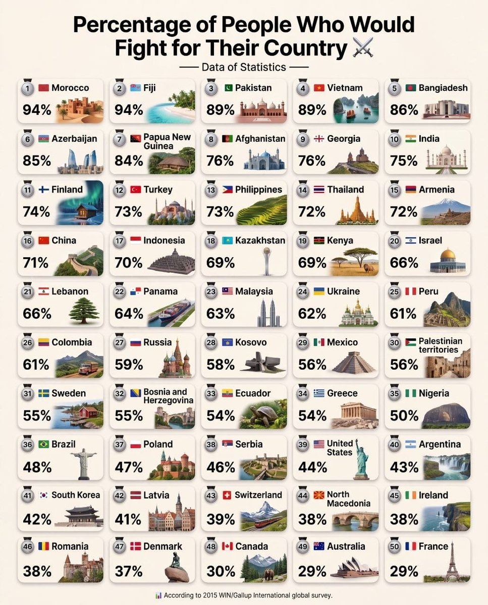 Countries willing to fight survey
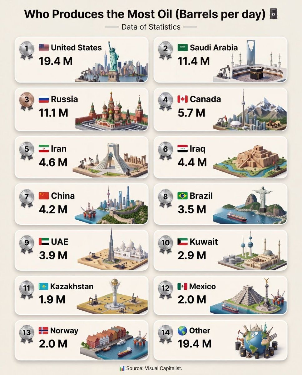 Global Oil Production Rankings
@savageupdatesJose Luengo-Carbrera maps out the hotspots across Africa.
Vedi post originaleFoto di @savageupdates· Aug 24, 2026· Info/Editorials
The image is a map of Africa showing areas of social unrest and armed violence. Red and blue circles indicate reported incidents, with larger circles representing higher frequency. A bar graph on the left shows the annual total of these incidents from 2004 to 2023. The overall mood is informative and serious, presented in a data-driven, analytical style. Visually notable are the dense clusters of red and blue circles in specific regions, highlighting areas of significant conflict. The map includes city names like Tunis, Rabat, Cairo, and Mogadishu, and a legend explaining the frequency by location. ON-SCREEN TEXT: Africa Social Unrest* & Armed violence** Reported incidents (01 Jan 2004 - 13 Dec 2024) Data: ACLED Visual: J. Luengo-Cabrera Annual total (01 Jan 2004 - 13 Dec 2024) Frequency by location (01 Jan 2004 - 13
Ancora nessun commento. Sii il primo!
white ethnic groups by U.S. countyIndia 1525 historical mapSecond most spoken language in MexicoDutch Language perception by regionlanguages of Chinahypothetical US state mapBolivia map and factsChile map with factsColombia maps and factsEcuador map and factsGuyana map and factsmost common US road suffixes by countySuriname map and factsPeru map and country factsWorld's Fastest Sinking Coastal CitiesTurkish Ancestry Population RankingsCountries willing to fight surveyGlobal Oil Production Rankings
Ancora nessun commento. Sii il primo!