
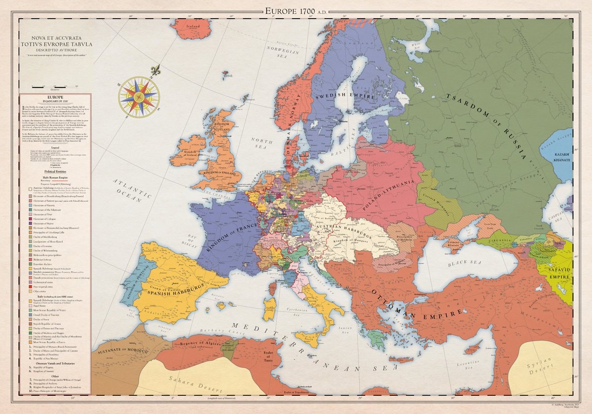
@scarlett_sA whole different map back then, Europe was something else in 1700
Vedi post originale@scarlett_sA whole different map back then, Europe was something else in 1700
Vedi post originaleFoto di @scarlett_s· Aug 30, 2026· News
The image is a historical map of Europe in 1700 AD. It displays political boundaries and territories with various colors representing different empires and kingdoms. The map has a vintage aesthetic with a compass rose and a detailed legend. A notable detail is the extensive coloring of the Holy Roman Empire into many smaller states. ON-SCREEN TEXT: EUROPE 1700 A.D. NOVA ET ACCVRATA TOTIVS EVROPAE TABVLA DESCRIPTIO AVTHORE "A new and accurate map of all Europe. Description of the author." Legend Political Entities Holy Roman Empire Boundary Additional (Habsburgs, Electors, etc.) Electorate of Bavaria Electorate of Cologne Electorate of Mainz Electorate of Trier Electorate of Saxony Electorate of Brandenburg Electorate of the Palatinate Duchy of Bavaria Duchy of Saxe-Lauenburg (Saxony) Duchy of Saxe-Gotha Duchy of Saxe-Meiningen Duchy of Saxe-Weimar Principality of Ansbach Princip
 2Mamdani sued by National Supermarket Association LOCAL 38 UFCW
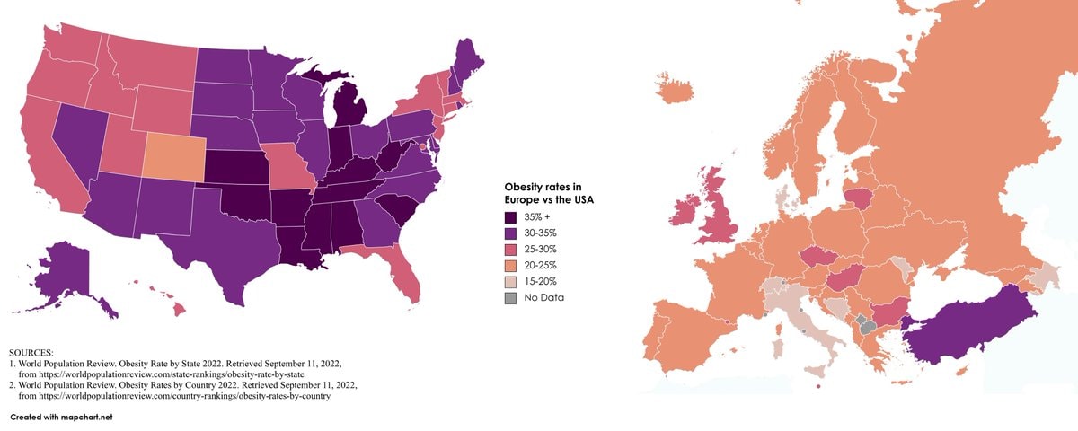 Europe vs USA obesity rates
 2Grand Theft Auto VI Miami Beach ad approval
 2United Airlines CEO Scott Kirby
 2PlayStation protest for physical games
 Bloodhound Q50
 Houthis Mocha campaign footage
 2American diplomat flown from UK
 Ronald Johnson 11-S cartel link
 Lady Gaga Michael Polansky baby
 2Kyiv petrol stations hit since Thursday
 2Fan Expo Dallas Peter Cullen memorial
 Judicial Watch sues Hasan Piker
 3Diesel #2 pump price surge analysis
 2Chopper crying One Piece
 Sophie Cunningham boyfriend reveal
 Devighat Nepal cable crossing after floods
 I'm single and searching 😔
@scarlett_sA whole different map back then, Europe was something else in 1700
Vedi post originaleFoto di @scarlett_s· Aug 30, 2026· News
The image is a historical map of Europe in 1700 AD. It displays political boundaries and territories with various colors representing different empires and kingdoms. The map has a vintage aesthetic with a compass rose and a detailed legend. A notable detail is the extensive coloring of the Holy Roman Empire into many smaller states. ON-SCREEN TEXT: EUROPE 1700 A.D. NOVA ET ACCVRATA TOTIVS EVROPAE TABVLA DESCRIPTIO AVTHORE "A new and accurate map of all Europe. Description of the author." Legend Political Entities Holy Roman Empire Boundary Additional (Habsburgs, Electors, etc.) Electorate of Bavaria Electorate of Cologne Electorate of Mainz Electorate of Trier Electorate of Saxony Electorate of Brandenburg Electorate of the Palatinate Duchy of Bavaria Duchy of Saxe-Lauenburg (Saxony) Duchy of Saxe-Gotha Duchy of Saxe-Meiningen Duchy of Saxe-Weimar Principality of Ansbach Princip
2Mamdani sued by National Supermarket Association LOCAL 38 UFCWEurope vs USA obesity rates2Grand Theft Auto VI Miami Beach ad approval2United Airlines CEO Scott Kirby2PlayStation protest for physical gamesBloodhound Q50Houthis Mocha campaign footage2American diplomat flown from UKRonald Johnson 11-S cartel linkLady Gaga Michael Polansky baby2Kyiv petrol stations hit since Thursday2Fan Expo Dallas Peter Cullen memorialJudicial Watch sues Hasan Piker3Diesel #2 pump price surge analysis2Chopper crying One PieceSophie Cunningham boyfriend revealDevighat Nepal cable crossing after floodsI'm single and searching 😔