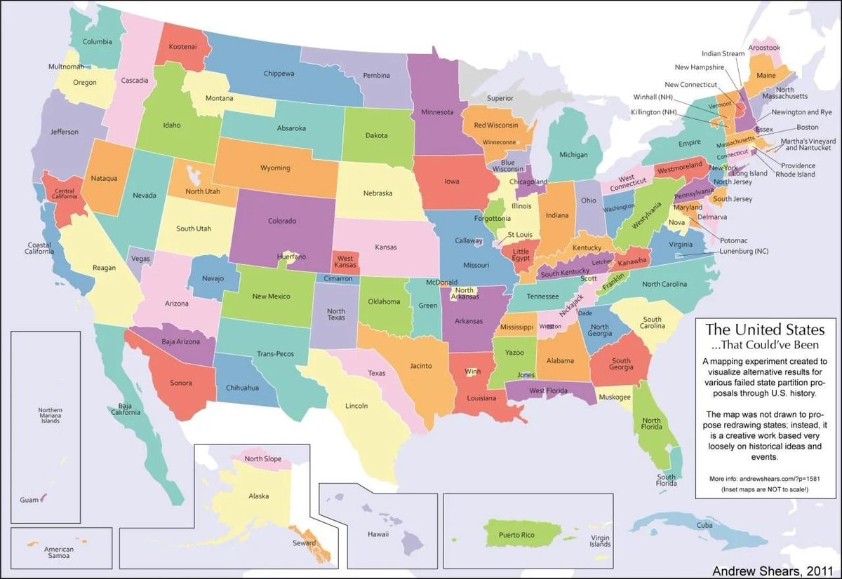
@scarlett_sThe 124 United States That Could’ve Been. #UnitedStates
Vedi post originale@scarlett_sThe 124 United States That Could’ve Been. #UnitedStates
Vedi post originaleFoto di @scarlett_s· Oct 16, 2026· United States
The image is a colorful, stylized map of the United States. It depicts an alternate history where states have been redrawn into different shapes and given new names. The mood is educational and thought-provoking, presented in a clean, infographic style. A notable detail is the text box in the lower right corner, which explains the map's purpose. ON-SCREEN TEXT: The United States ...That Could've Been A mapping experiment created to visualize alternative results for various failed state partition proposals through U.S. history. The map was not drawn to propose redrawing states; instead, it is a creative work based very loosely on historical ideas and events. More info: andrewshears.com/?p=1581 (Inset maps are NOT to scale!) Andrew Shears, 2011
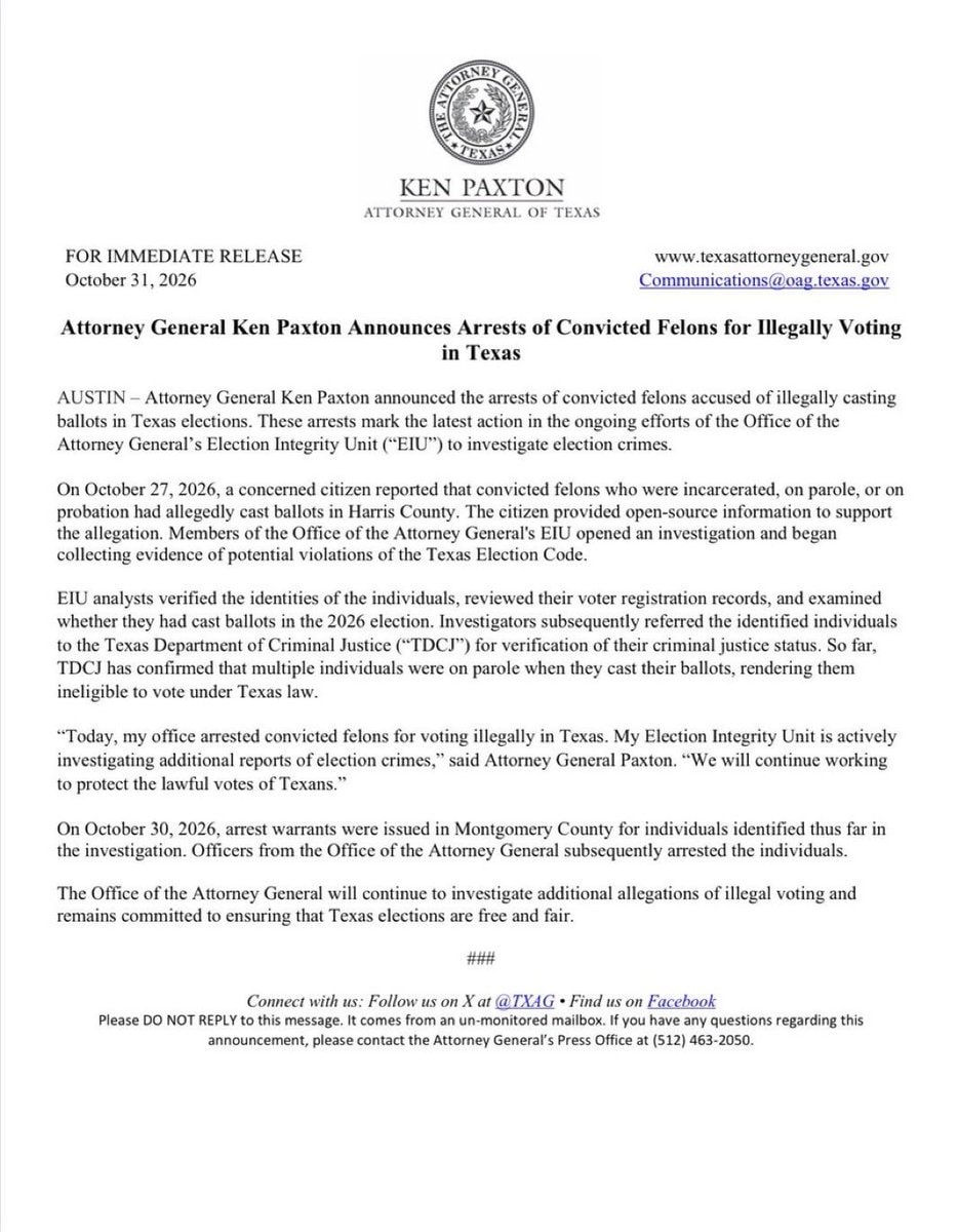 Ken Paxton arrests illegal voters Texas
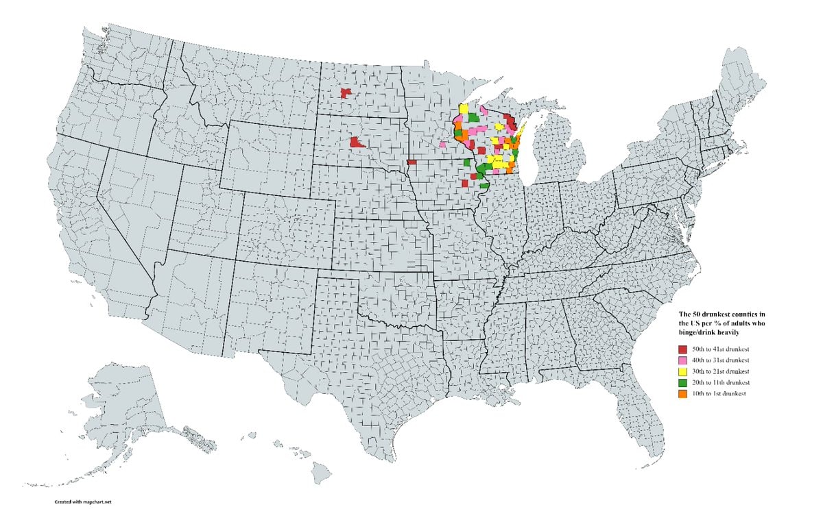 50 Drunkest U.S. Counties
 US brands by state of origin
 NYC #1 Halloween city 2026
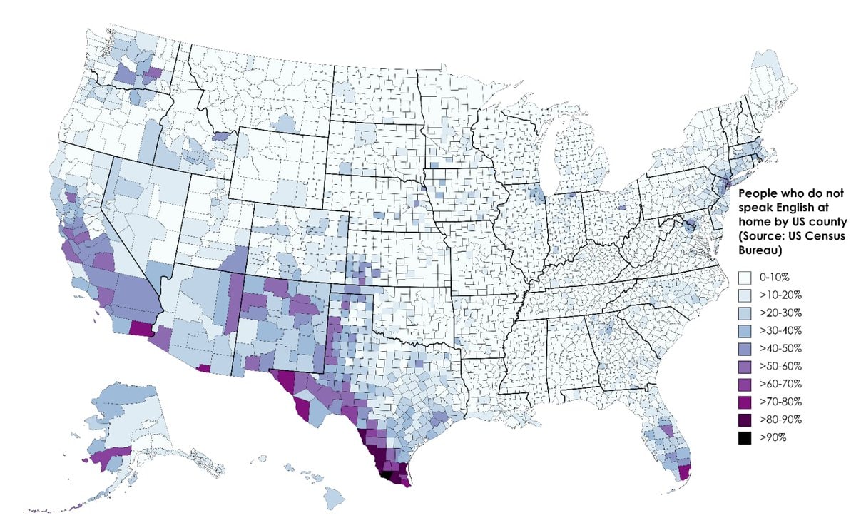 Non-English speakers by US county
 US stock market loss
 Pope Leo XIV votes in US election
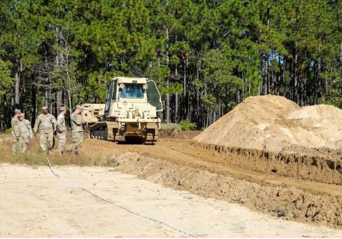 US Army battlefield interment exercise
 2Pete Hegseth fires Brett Sylvia
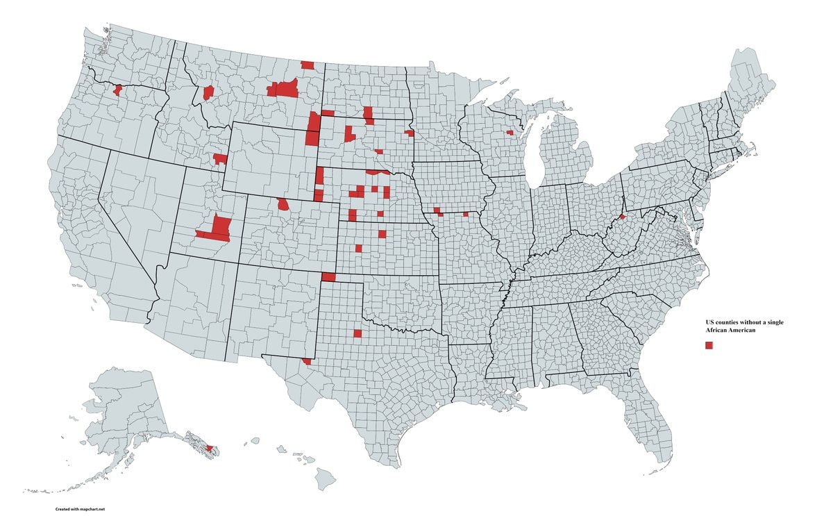 US Counties without African American residents
 2American brings cancer drug from China
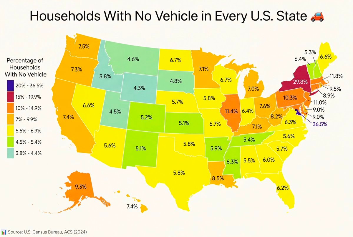 Households With No Vehicle in Every U.S. State
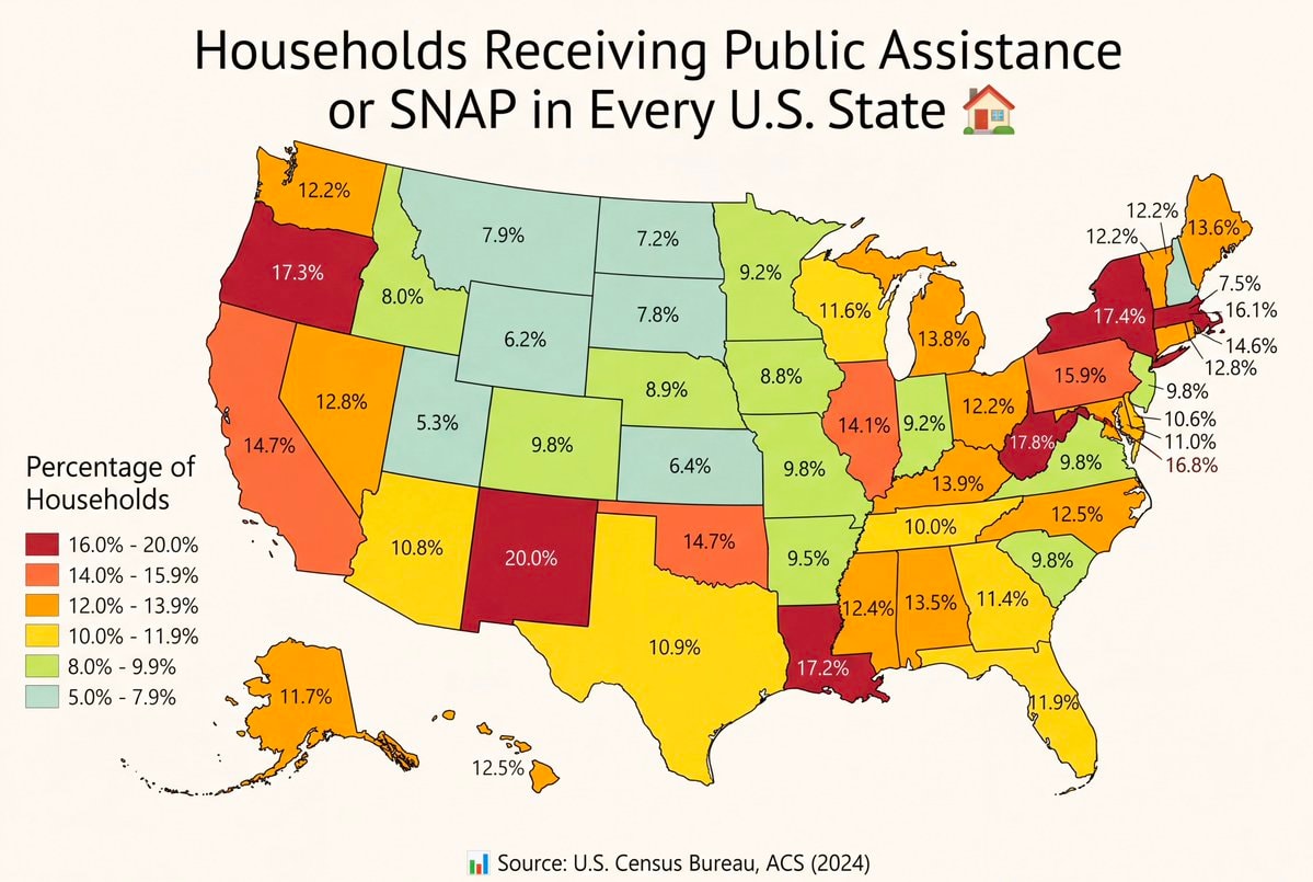 SNAP coverage by state
 Natural gas price gap: US vs Europe
 Hello everyone
@scarlett_sThe 124 United States That Could’ve Been. #UnitedStates
Vedi post originaleFoto di @scarlett_s· Oct 16, 2026· United States
The image is a colorful, stylized map of the United States. It depicts an alternate history where states have been redrawn into different shapes and given new names. The mood is educational and thought-provoking, presented in a clean, infographic style. A notable detail is the text box in the lower right corner, which explains the map's purpose. ON-SCREEN TEXT: The United States ...That Could've Been A mapping experiment created to visualize alternative results for various failed state partition proposals through U.S. history. The map was not drawn to propose redrawing states; instead, it is a creative work based very loosely on historical ideas and events. More info: andrewshears.com/?p=1581 (Inset maps are NOT to scale!) Andrew Shears, 2011
Ken Paxton arrests illegal voters Texas50 Drunkest U.S. CountiesUS brands by state of originNYC #1 Halloween city 2026Non-English speakers by US countyUS stock market lossPope Leo XIV votes in US electionUS Army battlefield interment exercise2Pete Hegseth fires Brett SylviaUS Counties without African American residents2American brings cancer drug from ChinaHouseholds With No Vehicle in Every U.S. StateSNAP coverage by stateNatural gas price gap: US vs EuropeHello everyone