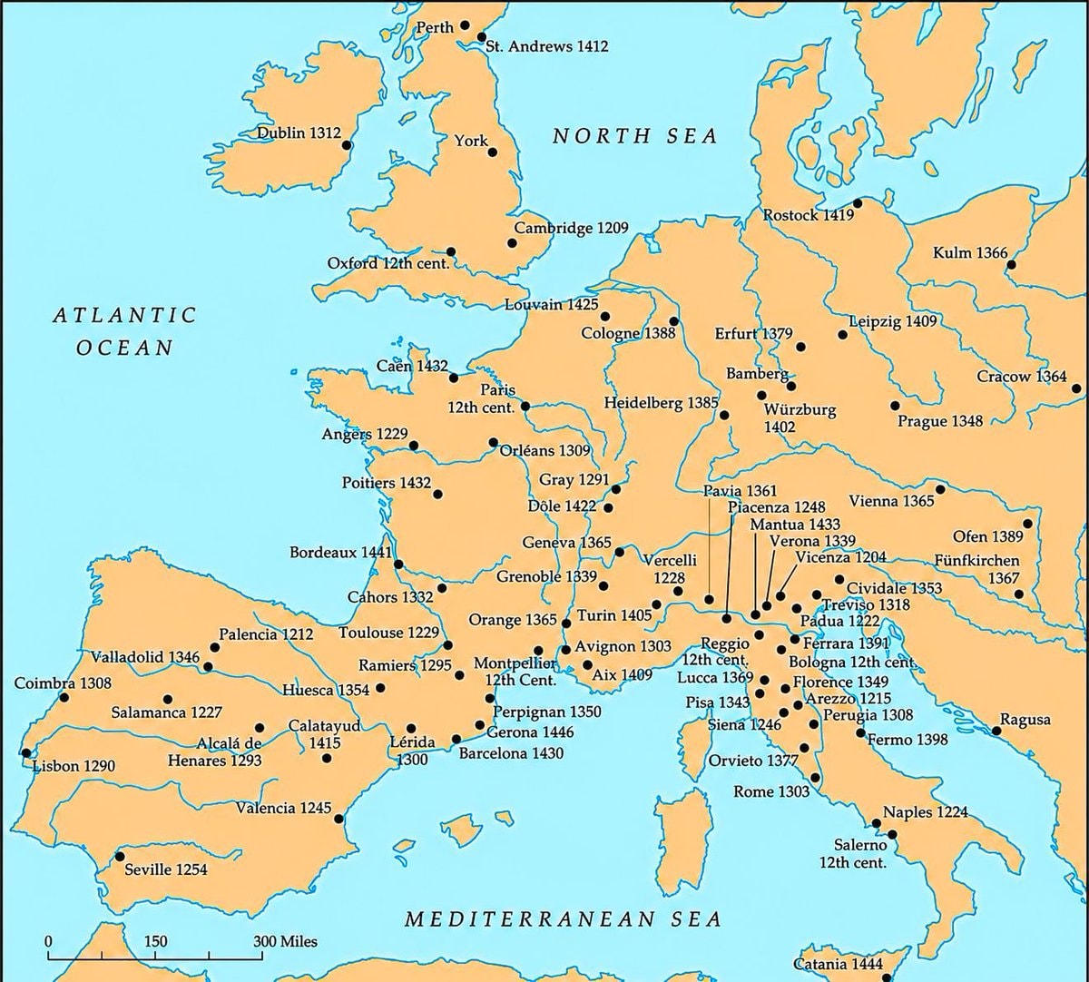
@scarlett_sWhere higher learning took root across Europe between the 12th and 15th centuries
Vedi post originale@scarlett_sWhere higher learning took root across Europe between the 12th and 15th centuries
Vedi post originaleFoto di @scarlett_s· Oct 26, 2026· Education
The image is a historical map of Europe. It shows various cities marked with black dots and labeled with their names and dates, indicating historical significance or events. The map covers Western and Central Europe, including Great Britain, France, Spain, Italy, and parts of Germany and Eastern Europe. The overall style is that of a classic educational map, with a muted color palette and clear labeling. Visually notable are the extensive labels and the geographical representation of the continent. ON-SCREEN TEXT: ATLANTIC OCEAN, NORTH SEA, MEDITERRANEAN SEA, Dublin 1312, York, Perth, St. Andrews 1412, Cambridge 1209, Louvain 1425, Cologne 1388, Erfurt 1379, Bamberg, Würzburg 1402, Rostock 1419, Kulm 1366, Leipzig 1409, Cracow 1364, Prague 1348, Paris 12th cent., Caen 143
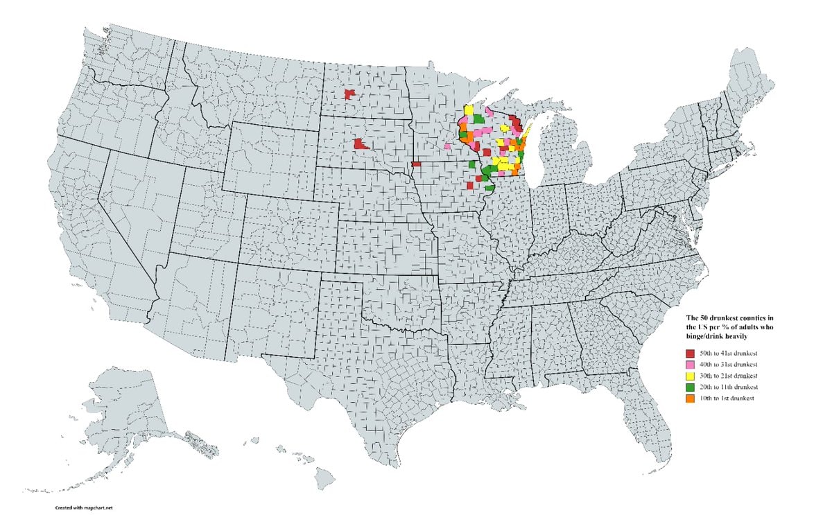 50 Drunkest U.S. Counties
 US brands by state of origin
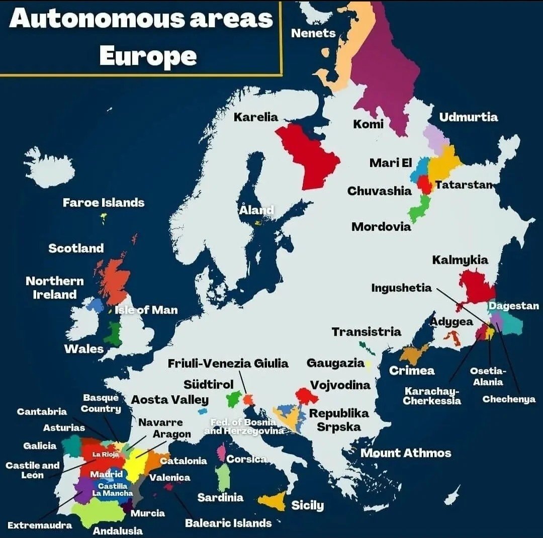 autonomous areas of Europe
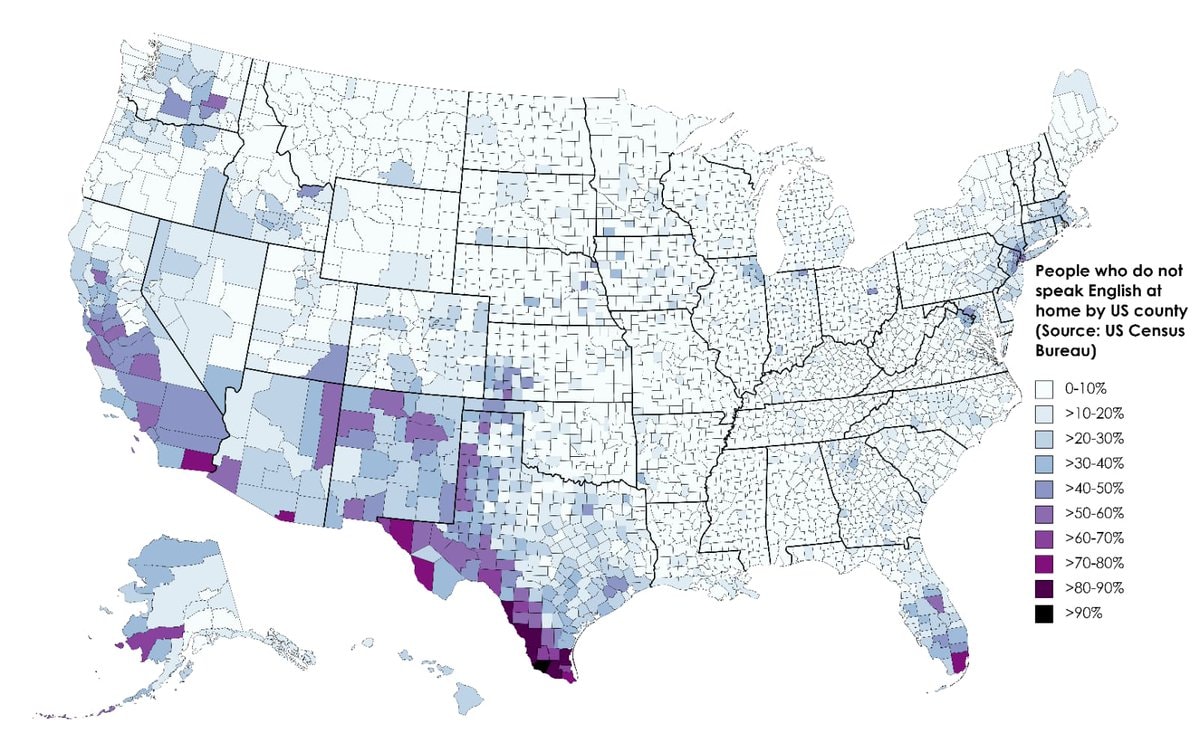 Non-English speakers by US county
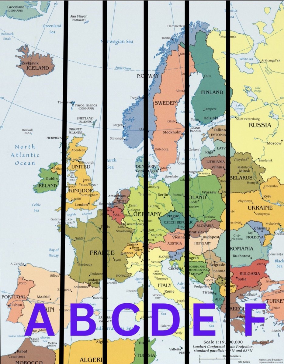 Two-week paid vacation Europe region map
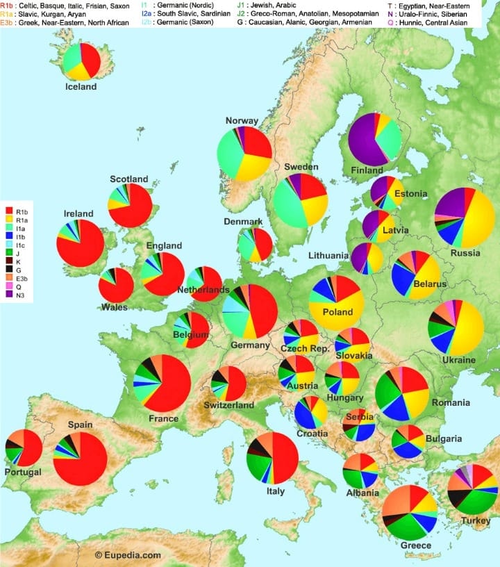 European DNA map pie charts
 2Sikh Population Canada 2021 Census
 Manhattan aerial night view
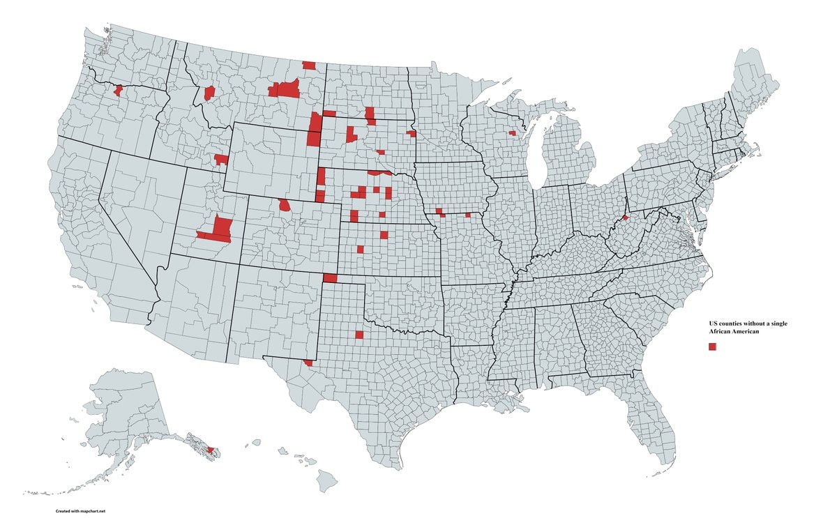 US Counties without African American residents
 France flag
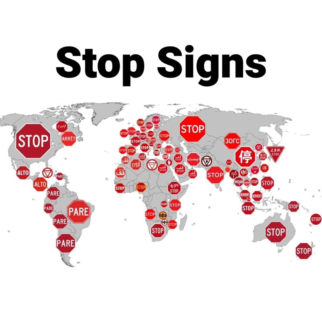 global stop signs by country
 Japan flag cultural norms
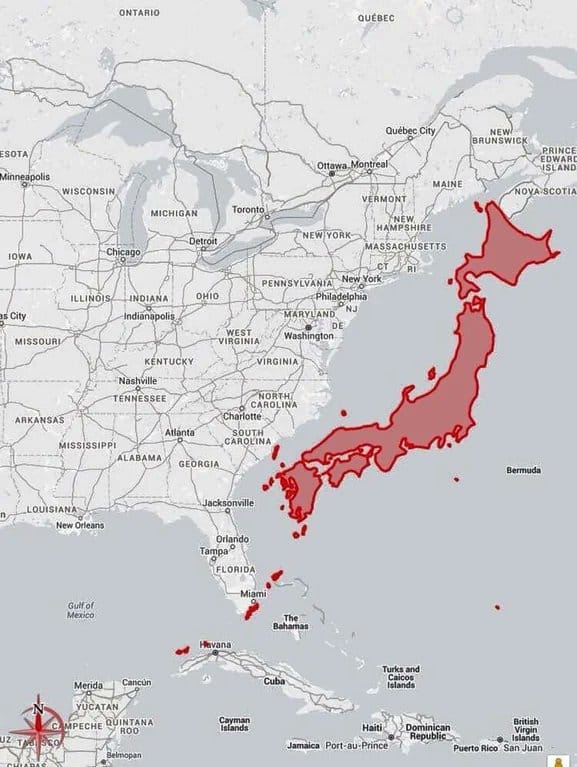 Japan vs US East Coast map
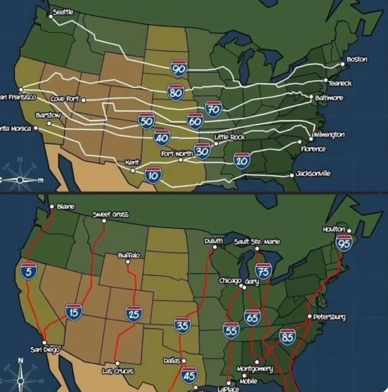 US Interstate highway numbering
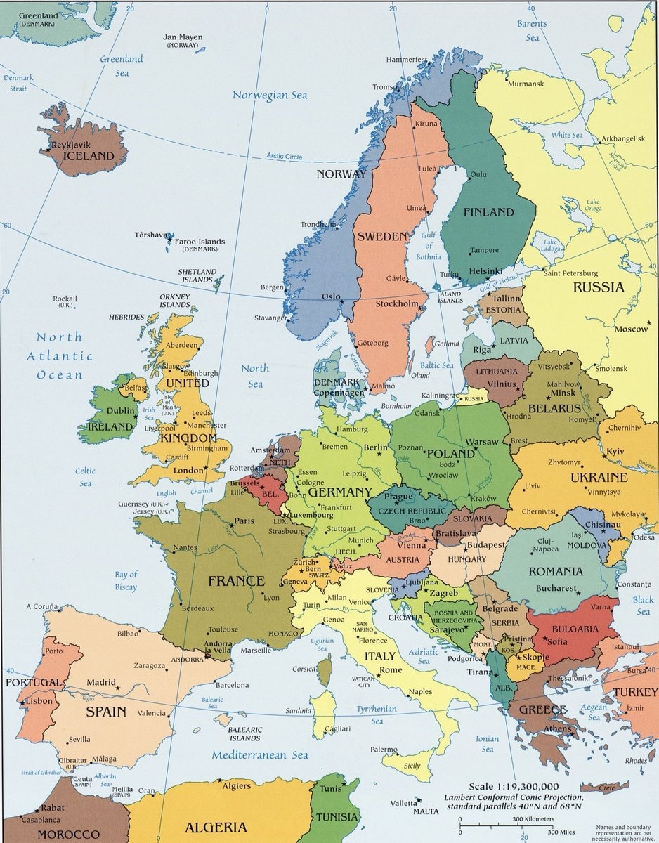 Least favorite country in Europe map
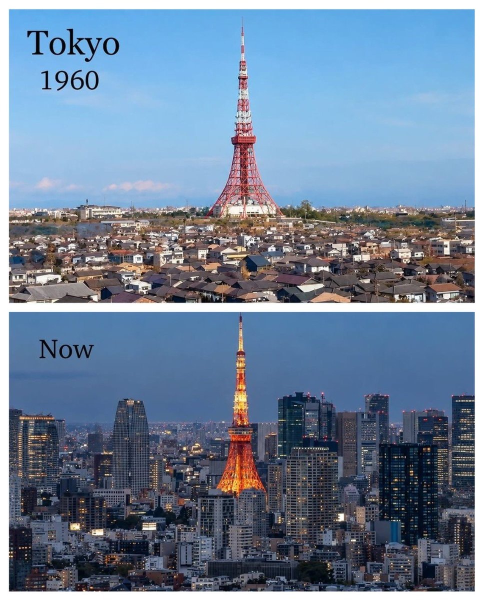 Tokyo 1960 vs present
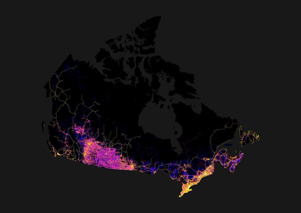 all roads in Canada
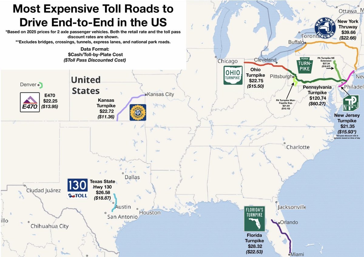 most expensive US toll roads map
@scarlett_sWhere higher learning took root across Europe between the 12th and 15th centuries
Vedi post originaleFoto di @scarlett_s· Oct 26, 2026· Education
The image is a historical map of Europe. It shows various cities marked with black dots and labeled with their names and dates, indicating historical significance or events. The map covers Western and Central Europe, including Great Britain, France, Spain, Italy, and parts of Germany and Eastern Europe. The overall style is that of a classic educational map, with a muted color palette and clear labeling. Visually notable are the extensive labels and the geographical representation of the continent. ON-SCREEN TEXT: ATLANTIC OCEAN, NORTH SEA, MEDITERRANEAN SEA, Dublin 1312, York, Perth, St. Andrews 1412, Cambridge 1209, Louvain 1425, Cologne 1388, Erfurt 1379, Bamberg, Würzburg 1402, Rostock 1419, Kulm 1366, Leipzig 1409, Cracow 1364, Prague 1348, Paris 12th cent., Caen 143
Ancora nessun commento. Sii il primo!
50 Drunkest U.S. CountiesUS brands by state of originautonomous areas of EuropeNon-English speakers by US countyTwo-week paid vacation Europe region mapEuropean DNA map pie charts2Sikh Population Canada 2021 CensusManhattan aerial night viewUS Counties without African American residentsFrance flagglobal stop signs by countryJapan flag cultural normsJapan vs US East Coast mapUS Interstate highway numberingLeast favorite country in Europe mapTokyo 1960 vs presentall roads in Canadamost expensive US toll roads map
Ancora nessun commento. Sii il primo!