
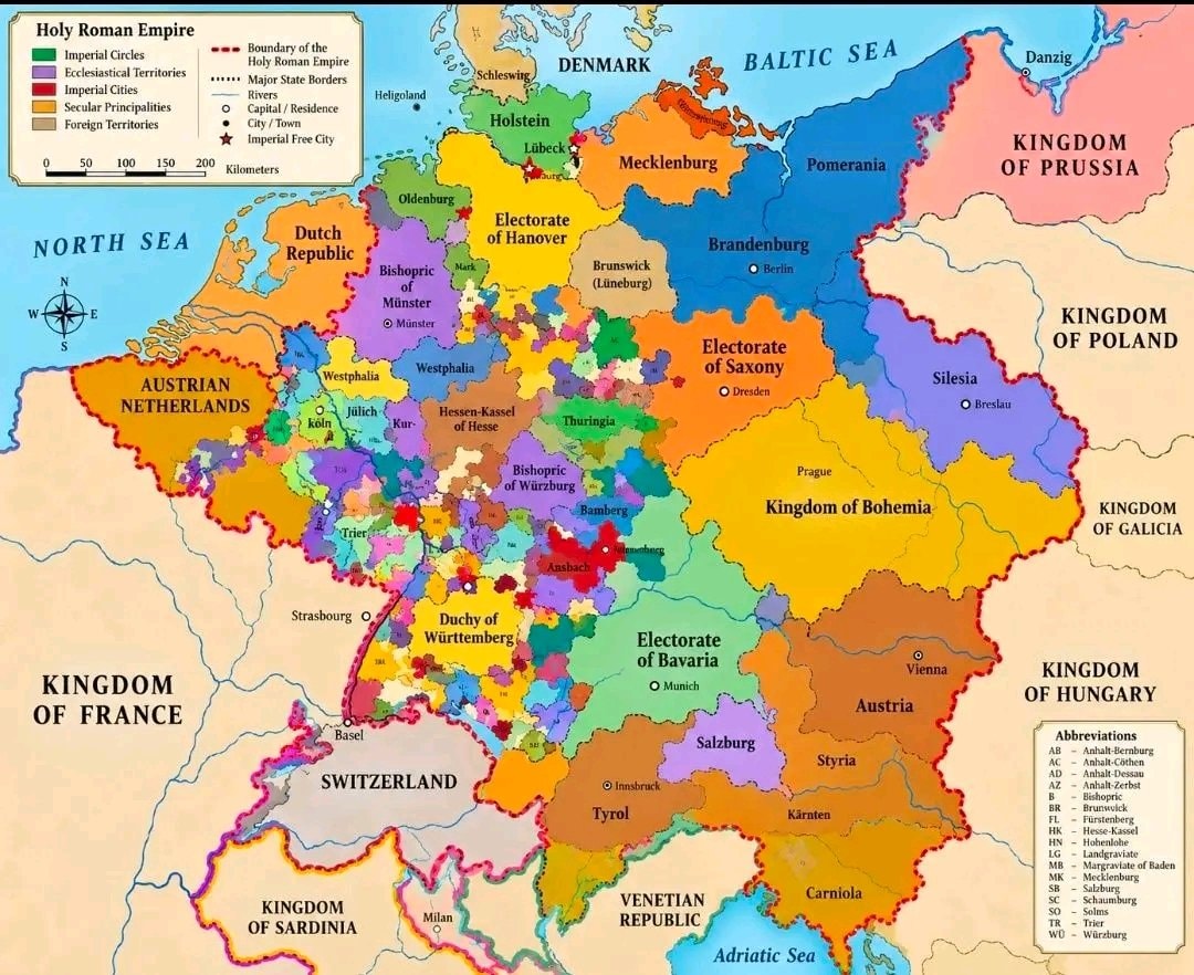
@savageupdatesMap of the Roman Empire in 1789. 🗺️
Vedi post originale@savageupdatesMap of the Roman Empire in 1789. 🗺️
Vedi post originaleFoto di @savageupdates· Sep 26, 2026· Info/Editorials
This is a colorful map of the Holy Roman Empire. It shows numerous small territories with different colors and labels. The map includes a legend explaining different types of territories and a scale bar. The style is educational and historical. A notable detail is the intricate subdivision of the empire into many distinct regions.
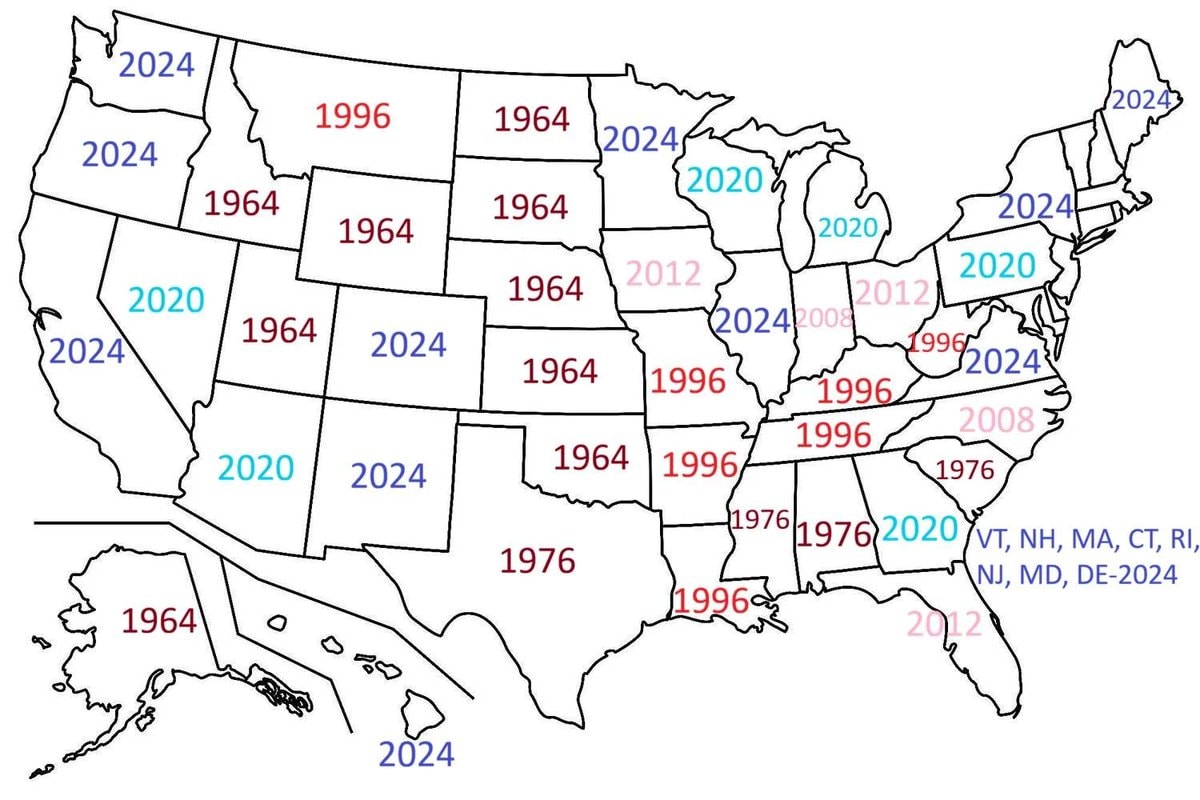 U.S. states last vote for Democrat
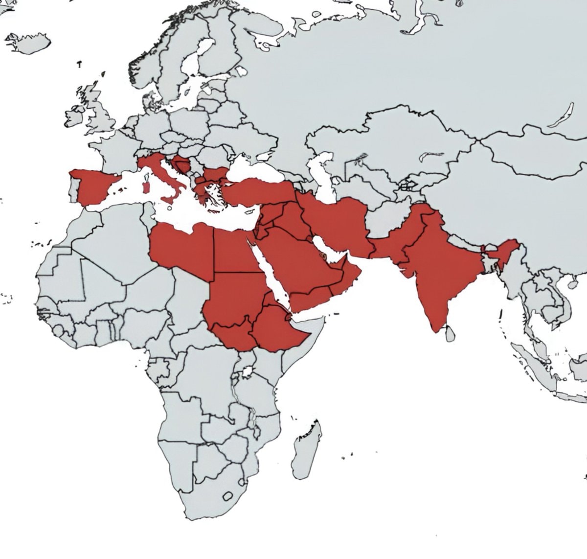 Nations Mentioned in the Holy Bible
 2Global Iconic Landmarks List
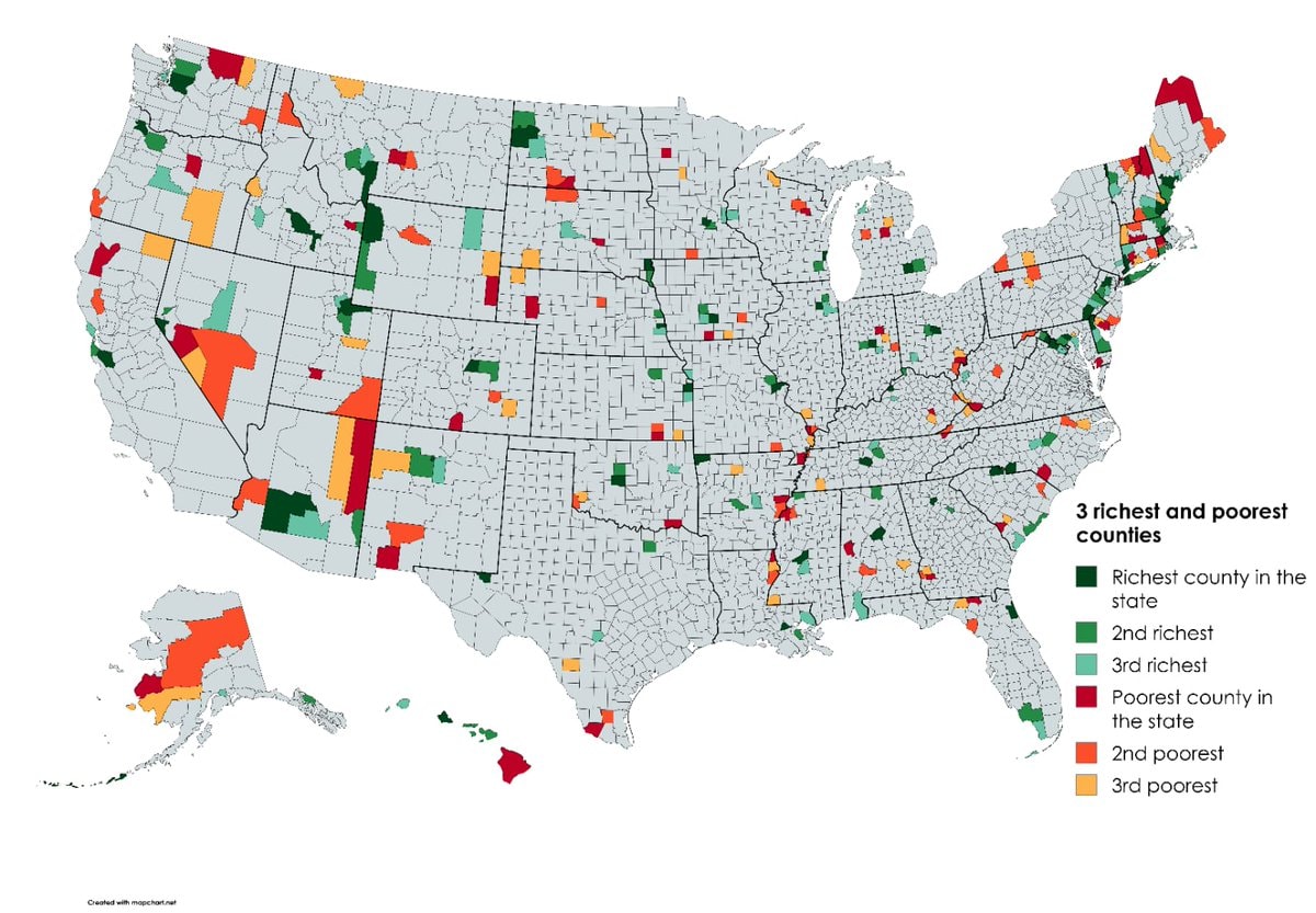 Richest and poorest US counties by state
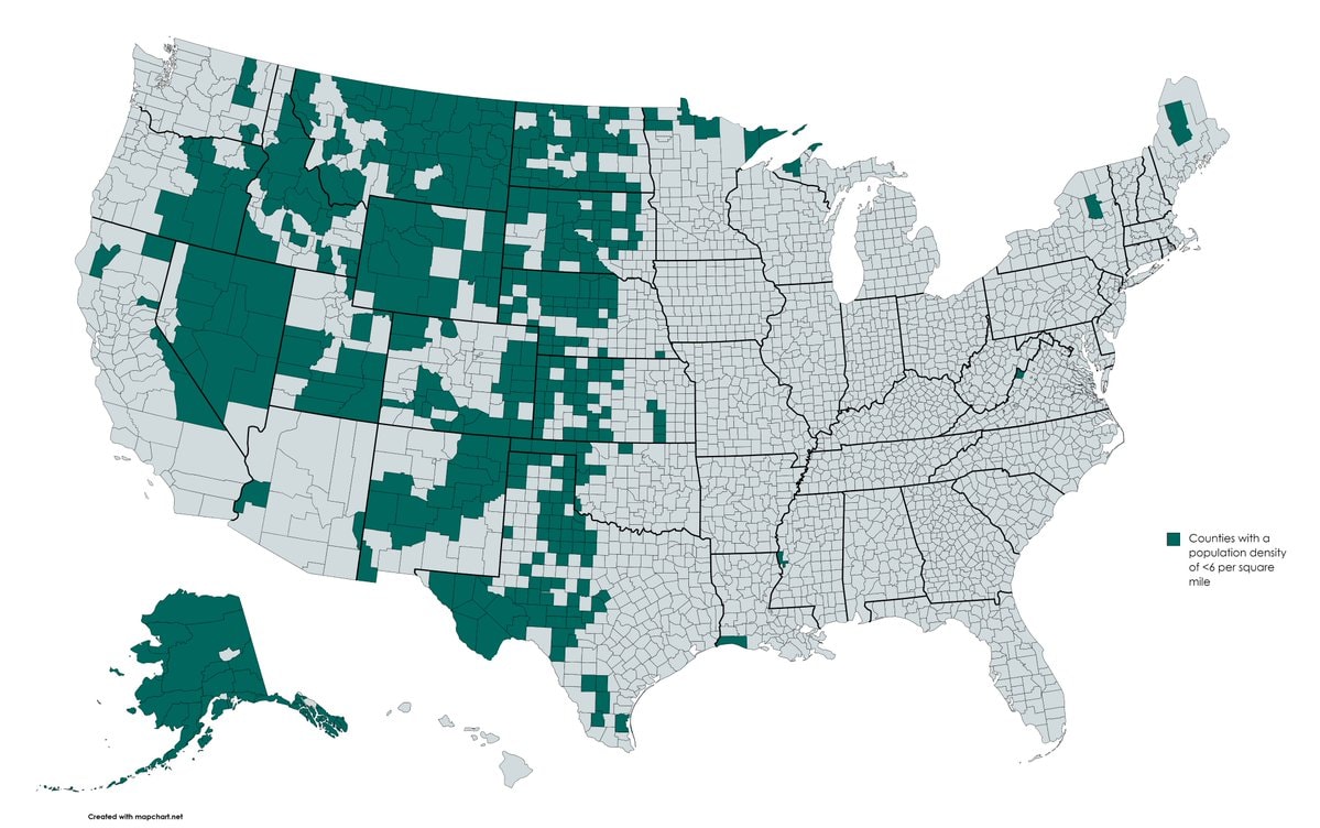 US counties under six people per square mile
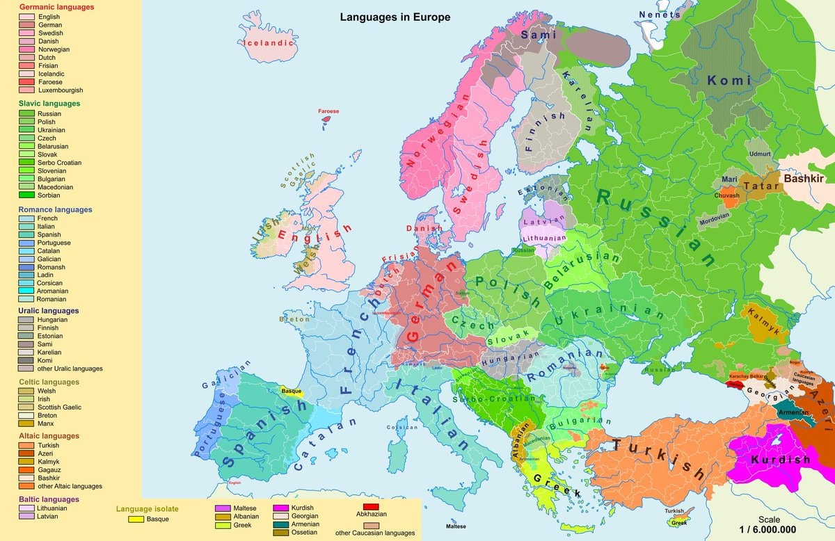 Linguistic map of Europe
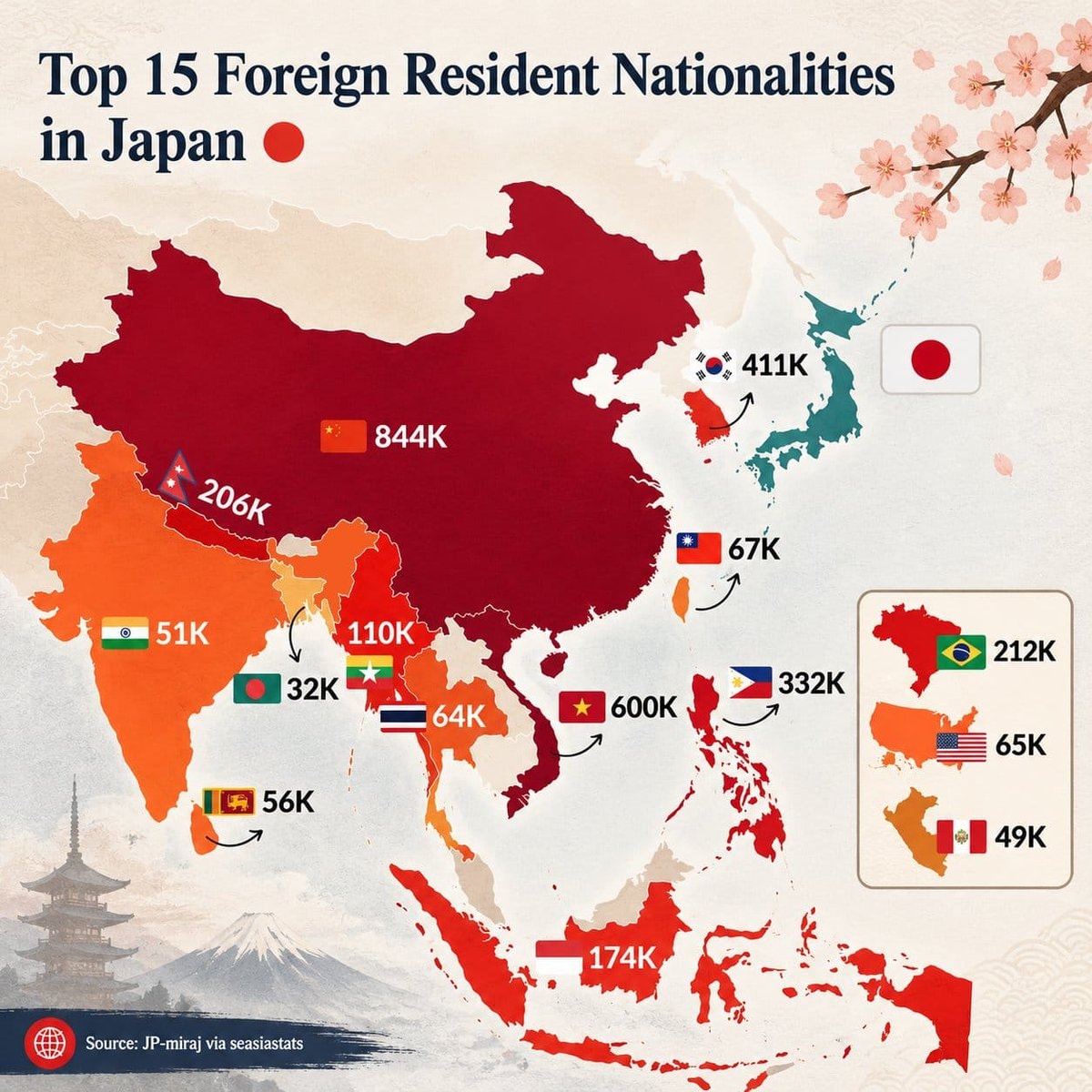 Top 15 Foreign Resident Nationalities in Japan
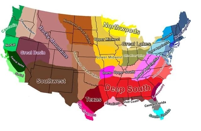 U.S. cultural regions map
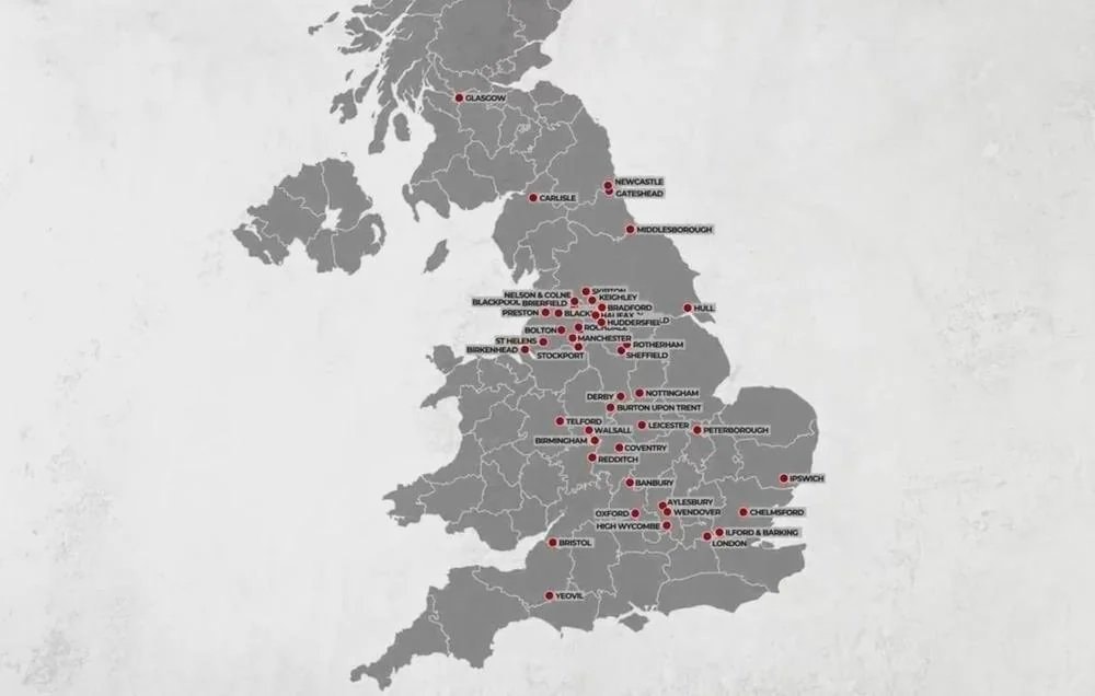 UK grooming gang activity locations
@savageupdatesMap of the Roman Empire in 1789. 🗺️
Vedi post originaleFoto di @savageupdates· Sep 26, 2026· Info/Editorials
This is a colorful map of the Holy Roman Empire. It shows numerous small territories with different colors and labels. The map includes a legend explaining different types of territories and a scale bar. The style is educational and historical. A notable detail is the intricate subdivision of the empire into many distinct regions.
Ancora nessun commento. Sii il primo!
U.S. states last vote for DemocratNations Mentioned in the Holy Bible2Global Iconic Landmarks ListRichest and poorest US counties by stateUS counties under six people per square mileLinguistic map of EuropeTop 15 Foreign Resident Nationalities in JapanU.S. cultural regions mapUK grooming gang activity locations
Ancora nessun commento. Sii il primo!